|
|
|
HAND-WROUGHT MAPS
By Pier Gustafson
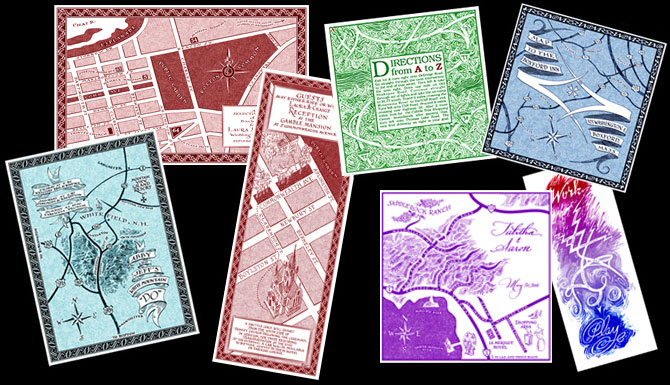
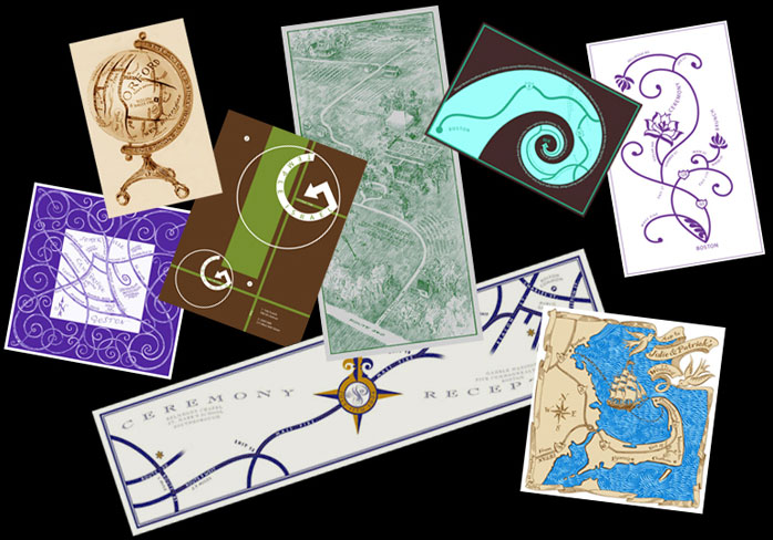
Below you'll find a selection of maps designed for a number of events. I have divided into numerous collections which will focus upon a particular aspect that WE may consider when I design a map for YOU.
Click on the any of the small maps to see them in greater detail.
|
|
|
|
 |
|
|
|
When designing a map our first concern is to decide what specific need it will serve. Presumably it will show someone how to get somewhere. Navigationally speaking we can divide them roughly into three distinct types.
The first type directs guests travelling from many starting points to one location. That sort of map might be used for a wedding held in a small town where guests are driving from many directions.
The second type directs people from a central spot (such as a hotel) to surrounding points of interest. Perfect for a "destination wedding" or a wedding that involves many events located at different venues throughout the area.
The third category is a map directing people from one starting point to one single destination -- from the church to the reception, for example. The one pictured below is a good example of that kind of map.
|
|
|
|
 |
|
|
|
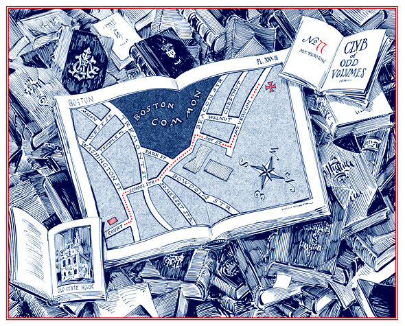
The pen and ink drawing above shows a "still life" composed of a pile of books with an open atlas in the middle. Its map shows the central part of Boston with a dotted line connecting the location of the ceremony held in the Old State House (pictured in the book at the lower left) to the reception at the appropriately-named "Club of Odd Volunes" (depicted by an open book at the top right).
Even though the distance between the two points was relativly short, the roads of Boston, (laid out initially by meandering cows and later by incompetant urban planners) almost require a map to navigate...even for the Brahmins who have lived there since the days of the Tea Party.
What inspired this map's artistic design was the knowledge that the couple was going to bring their own books to display on a table in the club's cocktail lounge. Guests who may have known only ONE of the pair were able to gain insight into the intersts of the other by looking at his personal assortment of "odd volumes."
|
|
|
|
 |
|
|
|
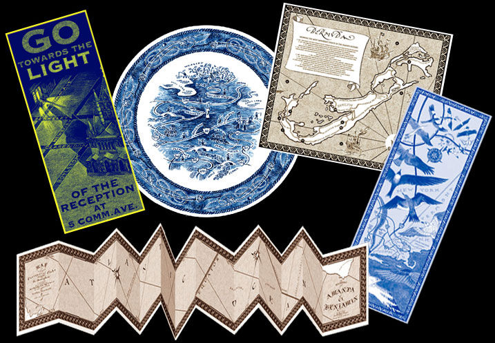
In addition to showing the geography of a place, a map can also be a great way to provide a concise schedule of events for your guests. Weddings these days are not just the ceremony and reception, but also brunches, sporting activities. concerts, BBQs, and other group functions. Each of the maps shown above contain a informational time-line. (Click on them to see more detail.) You can even provide many versions of the same map where the schedule is customized depending on what events each guest is invited to attend.
The one at the top had three versions printed: all were identical with the exception of what was to happen on Friday night. One listed the rehearsal dinner for those in the bridal party, another listed a "welcome party" at the yacht club for the out-of-towners. The third version was for a large family BBQ.
They can be customized even more. The piece shown below was a case in point.
|
|
|
|
 |
|
|
|
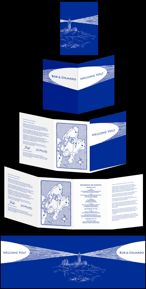
This small pocket-sized pamphlet was placed in the guests welcome baskets. The four interior sections contained a welcome letter, a map of the peninsula, a schedule of wedding events, and a list of suggested activities that could occupy their guests during the "down time." As the guests were quite diverse in taste Bob and Eduardo produced three versions of the pamphlet. The map and the schedule was the same for all three, but the welcome letter was personalized to each guest and list of activities were customized for three distinct sets of people. One for families with small children, directing them to the local beaches. Another for the folks who love to go antiquing. The third version was designed for the adventurous among them, introducing them to the area's sketchy night-life.
With the advent of desktop publishing (and printing), one can produce many versions of an item without paying for a new press run for each rendition.
|
|
|
|
 |
|
|
Once we know what has to be on the map, we can start thinking about how we will design it. Some of the many elements to consider is the size, shape, and color. Will the map be rendered in pencil, pen or even mechanically generated. While most match the invitation, they needn't. The one at the bottom right matched the bride -- well, the tattoos covering much of her body at any rate. When we start from scratch we can do anything! Check out the one below. |
|
|
|
 |
|
|
|
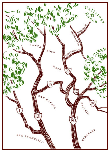
Drawn tree branches made up the decorative motif of the invitation and the RSVP card as well as the envelopes. It seems that I needed to include them on the map, too. But rather than simply having them be decorative, I composed them into the actual roadways. (Though I think of myself as a realist, I did bend some botanical laws of nature with highways 12 and 37.) |
|
|
|
 |
|
|
|
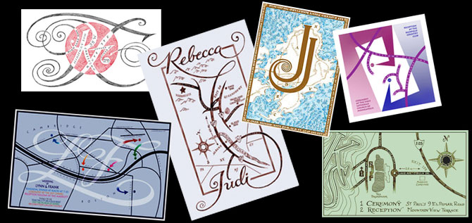
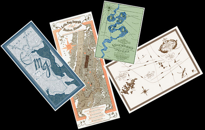
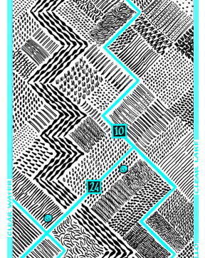
One way of personalizing a wedding map is to incorporate the names or initials of the couple in the design. Initials may be found repeated over and over creating a decorative border or may be placed in the center of the compass rose. Quite often they can become integral to the structure of the composition as shown in those above. Click on them for more detail. (Just a warning, sometimes the initials and the landscape DO NOT work together as well as others. I do try to follow the rules of typography as well as geography.) |
|
|
|
 |
|
|
|
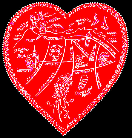
The heart shape map shown above was presented to the wedding guests as they left the church. It was printed on the lid of a candy box...filled with assorted munchies to hold the group for the next two hours. They all boarded charter trolley cars for a tour of the couple's romantic history in San Francisco. They started the tour with where they met, then on to the first date, to the place where he proposed, along with other important sites along the way. The trolley eventually ended at the reception site.
Each map I design is created especially for the specific event.
No pre-configured templates are used and no trite clip-art is simply cut and pasted. Everything is drawn from scratch for each individual need. If you want your map to have a certain look, such as a Victorian, I'll research that style and draw it accordingly. If you want the images and lettering to be more "casual" in appearance, such as the one above, I'll draw them to suit your taste.
|
|
|
|
 |
|
|
|
Maps need not play second fiddle to the invitation: they can become the invitation! (Kill two birds with one stone.) They also make a meaningful vehicle to deliver a "save-the-date" announcement, especially for a "desitnation wedding."
Weddings need not be the only event where a map-invitation can be used. Look at the one below.
|
|
|
|
 |
|
|
|
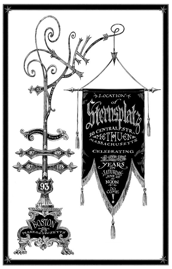
The owner of a Victorian house planned a grand re-opening celebration after it had gone through extensive historic renovations. An elaborate claw-footed post holds a fringed be-tassled banner containing the text of the invitation. Only after you study it for a moment, do you realize that the post is actually the map directing his guests from Boston.
Sometimes my maps don't look like maps at the outset, but they are painstakingly researched so that the geography of the map is as accurate as need be. If the driving requires delicate navigation, I'd design the map to be more traditional, and leave the decoration to the borders.
|
|
|
 |
|
|
|
When all the variables come together "perfectly" our collaboration results in creating a piece of inspired cartographic art which is as beautiful as it is functional. Click on the images above to read about what inspired their unique look. |
|
|
|
 |
|
|
|
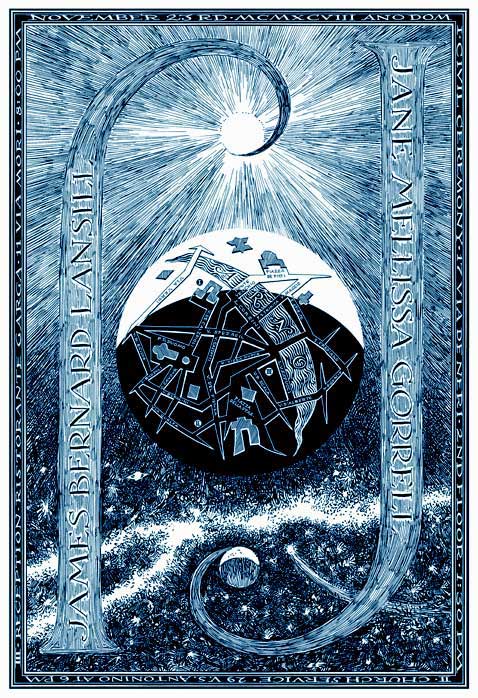
The map above had any number of factors to it which happened to align (like the planets) just right, allowing for this beautiful result. In Florence, it seems, one needs a civil ceremony before you can have a church service. The two official events needed to be marked on the map. One was held in the daytime, the other that evening. The city is shown under both the sun AND the moon. The names of the bride and groom, both starting with a J, are shown terminating in the heavenly bodies. One concern I had was which person would be which celestial object. I allowed the Italian language to decide for me: the moon was feminine and the sun masculine. That settled it.
When our collaboration works well, the result is an example of cartographic art...suitable for framing as was the one shown below.
|
|
|
|
 |
|
|
|
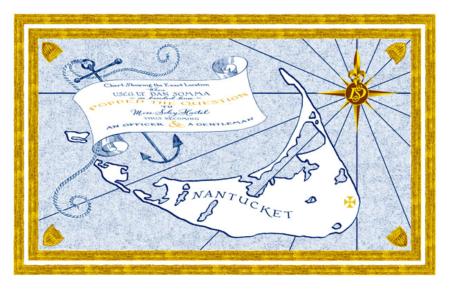
This map was the wedding present from the bride to the groom. It commemorated his proposal to her. I liked the "treasure-map" look of the single "X marks the spot" on an otherwise empty-looking island. I came up with the wording which seemed to accentuate the romance of the event. The border of the map was inspired by the stripes found on his (Lieutenant's) uniform. The shields in the corners are the insignia of the Coast Guard.
|
|
|
 |
|
 |
|
|
|
The map at the left was inspired by the landscape of the midwest. Looking down from the air we see a grid pattern laid out by surveyors using the "township and range" method of creating property lines. Rectangles and squares of furrowed farmland appear quilt-like when seen from aloft (dontcha know).
That quilt pattern inspired this map. That and the Prarie School of decorative arts (stained glass) and architecture.
The map shows how to get to the fishing boat tied to the dock of "The Cabin" at "The Lake" in the wilds of central Minnesota.
What they really need, however, is a map showing where the six fish that inhabit that lake are located.
|
|
|
|
 |
|
|
|
Unable to catch those fish during the summer, these stubborn midwesterners go up north after the lake freezes. They sit for hours in a tiny ice house. The version on the right was designed for their winter travels. |
|
|
 |
|
|
And now for something completely different.
|
|
|
|
 |
|
|
|
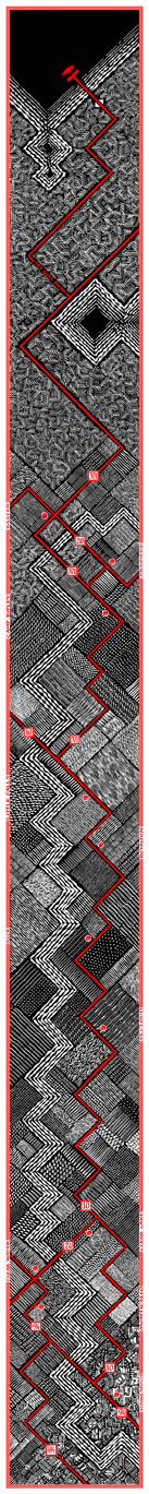
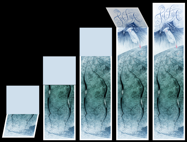
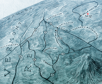
Here's a fun map designed for wedding far, far,far up in the White Mountains.
|
|
|
|
 |
|
|
|
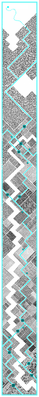
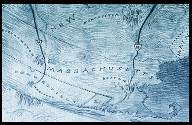
The small, select group of guests were starting from either Hartford, Northampton, Boston or Manchester. As they unfolded this map (from the bottom), they easily locate their starting points on the first exposed panel. |
|
|
|
 |
|
|
|
As they unfold the map further they find their car, and those of their fellow guests driving ever northward. |
|
|
|
 |
|
|
|
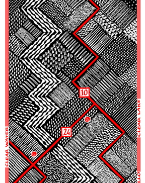
When the geography of the map requires more "realism", I provide a more traditional map including town names, and mileage markers. They eventually reach their goal. |
|
|
 |
|
|
|
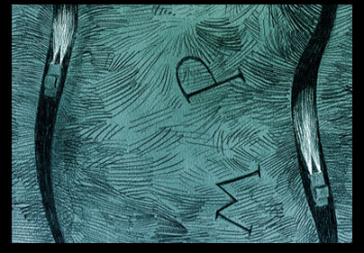
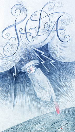
After all that driving, I felt it was necessary to have a climax of some sort. As you unfold the last two panels you see the punchline: "Ta Da", calligraphed in the clouds out of which eminate lightning bolts and the nattily dressed "Hand of God." He points to the X on the map marking the location of the wedding. |
|
|
|
 |
|
|
|
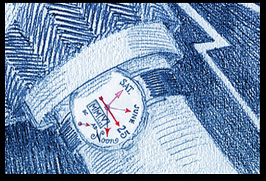
His watch tells you what time He expects you to be there: Sat, June 25, noon, MMV (AD).
I had planned to include "3,529,046,021 shopping days til the Last Judgement", but there wasn't room for it on the dial.
|
|
|
|
 |
|
|
|
Often I am asked to create a world map showing all the places on the planet where a client has visited or lived. Usually that leaves vast empty areas where the client hasn't visited...so I have developed my version of LIFE MAPS.
An example is shown above but more can be seen on my LIFE MAP page.
|
|
|
|
 |
|
|
|
 |
|
|
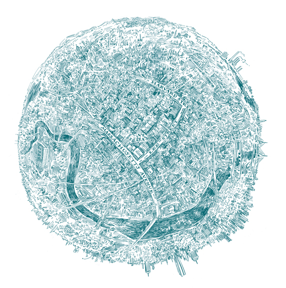
| Here's a map showing the location of a new home. Right in the center of the universe, just like YOUR home.
I also include nearby areas of importance to the homeowners. You see a detail at left. The Harvard Boat team racing to victory at the "Head of the Charles" Race, and the Red Sox knocking a ball over the Green Monster at the World Series.
|
|
|
|
The cost of designing a map can be "all over the map." Most run between 400 and 600 dollars (printing the maps is not included). You can see some samples of actual costs of some of the maps shown above by clicking here. Some may be much more depending on any number of factors.
More map samples may be seen here. and on the "what's new" page. Check them both out.
Before I can give you an estimate, I'll need to know what sort of map it will be and how many locations will be placed on the map.
|
|
|
|
 |
|
|
|
Click on the links below to navigate this site.
|
|
|
|
|
|
|
|
|
|
|
|
|
|
|
|
|
|
|
|
|
|
|
|
|
|
|
|
|
|
|
|
|
|
|
|
|
|
|
|
|
|
|
|
|
|
|
|
|
|
|
|
|
|
|
|
|
|
|
|
|
|
|
|
|
|
|
|
|
|
|
|
|
|